180 results filtered with: Map
- Maps
Study in human starvation. 2, Diets and deficiency diseases / [prepared by] the American Geographical Society ; E.D. Weldon, cartographer.
Date: 1953
- Pictures
- Online
Map of Ireland, showing Scottish and Welsh coasts. Engraving after J. Speed, 1610.
John SpeedDate: Anno Domini 1610Reference: 576766i
- Pictures
- Online
Sweden: map. Engraving, 1808.
Date: [1808]Reference: 677648i
- Pictures
- Online
Southwark, London: map of the borough with key. Etching, 1755.
Date: 1755Reference: 24979i- Books
Cornwall / Duphar Laboratories.
Date: 1971- Books
The Wye valley / Duphar Laboratories.
Date: 1970
- Ephemera
- Online
Back pocket guide to gay & lesbian London : issue 3 / JWH Design, Back Pocket Guides.
Date: [1993]- Books
Into the past of... England & Wales : an historical map presented by the manufacturers of Terramycin / Pfizer.
Date: [1963]- Pictures
Map of the Holy Land in the time of Jesus Christ. Colour lithograph.
Date: 1880Reference: 576749i- Books
List of the health and pleasure resorts, altitude and indication where to find them on this map.
Date: [1955]
- Pictures
- Online
Memorial of events concerning Prussia from the year 1707. Engraving, c. 1722.
Reference: 26399i
- Pictures
- Online
Map of Northern Africa; African people in a rococo frame on the upper right hand of the map. Coloured engraving, 1772.
Jean Baptiste Bourguignon d'AnvilleDate: 1st August 1772Reference: 576757i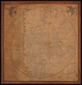
- Pictures
- Online
Handkerchief printed with a map of London. Engraving, 1820/1843.
Date: [1820/1843]Reference: 584091i- Maps
Asien auf Karten von der Antike bis zur Mitte des 19. Jahrhunderts = Asia in maps from ancient times to the mid-19th century / herausgegeben und erläutert von Egon Klemp ; [translated from the German by Alison and Alistair Wightman].
Date: [1989]- Books
North Devon / Duphar Laboratories.
Date: 1970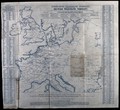
- Pictures
- Online
Telegraph stations in Britain and Europe. Engraving (?).
Date: 1860-1869Reference: 37511i- Pictures
London: Stanford's two-inch map. Colour lithograph, 1906 (?).
Date: [1906?]Reference: 40351i- Maps
Distribution of helminthiases / [prepared by] the American Geographical Society.
Date: [1952]- Maps
Distribution of plague 1900-1952 / [prepared by] the American Geographical Society.
Date: [1952]- Ephemera
Olympic Park map : London 2012 Paralympic Games / London Organising Committee of the Olympic Games and Paralympic Games Ltd.
Date: 2012- Pictures
Map of British India with four vignettes. Coloured engraving by J. Rapkin, 1851.
John RapkinDate: [1851]Reference: 585748i
- Pictures
- Online
A map of London, with a scale and north point: from Greenwich to Hammersmith east-west, and from Highgate to Stockwell north-south. Wood engraving by J. Dower after himself, 1862.
Dower, John, active 1855-1877.Date: 24 May 1862Reference: 40421i
- Ephemera
- Online
Gay Buddy : May 2011 / Antares Media Ltd.
Date: 2011
- Pictures
- Online
Messina, Sicily, Italy: map of the port; with numbered key. Tinted aquatint after Villamaga, 1699.
Villamaga.Reference: 18376i
- Pictures
- Online
A general plan of the layout of the Royal Naval Hospital, Greenwich, with a scale and north point. Coloured lithograph, 1858, after P. C. Hardwick.
Hardwick, Philip Charles, 1822-1892.Date: 1858Reference: 29348i