Palestine: the physical geography and natural history of the Holy Land / By John Kitto. Illustrated with one hundred and seventy-one woodcuts, by the most eminent artists.
- John Kitto
- Date:
- 1841
Licence: Public Domain Mark
Credit: Palestine: the physical geography and natural history of the Holy Land / By John Kitto. Illustrated with one hundred and seventy-one woodcuts, by the most eminent artists. Source: Wellcome Collection.
39/456 page 27
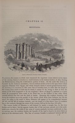
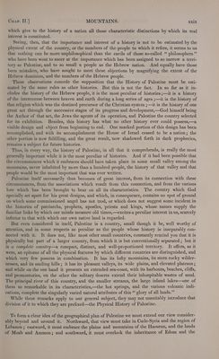
![CHAPTER II. MOUNTAINS. Aiur eet a iii nui SNES : : LCN aN SS SE Ue trip ‘au ie ‘hi ie is pun i i mule = ARS we = LE b>) ges WLR \g wt “We A Ss _ ES NWN Wy / ‘ 3 LES Hs EW) =~ ZO UR G, <S Ly We ne INS Bo WAS CS ate , Ns EE RSS Se & iE ee <—F _ RAN Pi (ef ry &> ey We re, BONES [Scene in Mountains of Gilead—Ruins of Jerash.] Paestine, the country in which were transacted the important events which it is the object of the ensuing history to record, is a small territory on the western borders of Asia, fronting the Mediterranean, being the south-eastern portion of Syria. On the north this territory is bounded by the Lebanon mountains; but its southern border is lost in the open desert which separates Palestine from Egypt, and which formed a kind of neutral ground between them. As, however, it is necessary to take some line of boundary here, in order that the length of the country from north to south may be stated, it cannot be far wrong to draw it from the stream of El Arish (supposed to be the scriptural “ River of Egypt”), eastward to a point about 25 geographical miles south of the Dead Sea, on the borders of that valley which extends between that Sea and the Gulf of Akaba. Assuming this southern boundary, and fixing the northern one at the parallel of the stream which flows from Lebanon into the sea about five miles to the north of Sidon, Palestine will appear to he comprehended between 30° 40’, and 33° 36’ of northern latitude; and the length of a line drawn from the northern line to the southern, through the centre of the country, will not be less than 180 miles. The eastern border of Palestine is well defined, in nearly a straight lime, by the river Jordan and its lakes; but the opposite border, that of the sea-coast, spreads out to the south- south-west, whereby the width of this strip of country gradually increases southward, so that, on arriving near the southern border, the breadth of the land is found to be about thrice as ereat as in the uttermost north. The line of extreme breadth is embraced between 33° AB e 2](https://iiif.wellcomecollection.org/image/b22013271_0039.jp2/full/800%2C/0/default.jpg)

 No text description is available for this image
 No text description is available for this image
 No text description is available for this image