Sales catalogue 43: Henry Stevens, son & Stiles
- Date:
- 1949
- Reference:
- WA/HMM/CM/Sal/50/6
Licence: Public Domain Mark
Credit: Sales catalogue 43: Henry Stevens, son & Stiles. Source: Wellcome Collection.
30/36 page 28
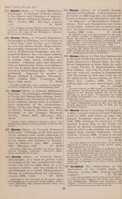
![America. A Comparison of the Social and Political State of Both Nations. Lon- don, 1833. 2 vols in 1, half calf. 8° $5.00 Facsimiles of the Waldseemuller World Maps of 1507 and 1516. The Oldest Map with the name America of the Year 1507, and the Carta Marina of 1516. By W. Waldseemiiller (Llacomilus). Edited by Prof. Jos. Fischer, S.jJ., and Prof. Fr. R. v. Wieser. London, 1903. Text 55 pages with 27 sheets of maps, each 30 by 21 inches, in a portfolio. Roy. folio. $48.00 The map of 1507 was originally issued with the well known geographical treatise ‘“‘ Cosmographi# Intro- ductio,’”’ in which America was first suggested as the name for the newly-discovered western con- tinent ; but although many copies of the book in various editions are preserved, no copy of the map was known until Professor Fischer was fortunate enough to discover one in the library of Wolfegg Castle in 1901, bound up in a volume with the map of 1516, also unknown. The outcome of this double discovery is the present sumptuous reproduction. No American library can afford to be without a copy of this corner-stone of American history. The Times, in reviewing the work, said: “It is no exaggeration to say that it is hardly possible to unearth any more interesting or more important cartographical treasure.”’ 344 Warden (D. B.) Statistical, Political, and Historical Account of the United States of North America; from the period of their first colonization. Edinburgh, 1819. 3 vols, large folding map of the U.S. A., Plan of the City of Washington with inset view of the Capitol, fine copy, original boards, uncut, with paper labels. 8° $15.00 Includes descriptions of the Illinois Territory, Michigan, Missouri, the country between the Rocky Mountains and the Pacific, including the Columbian Valley, with a long account of the Indians. Printing in America. Books, Pamphlets and Some Articles in Magazines Relating to the History of Printing in the New World. Boston, 1906. Oviginal printed wrappers. Roy. 8° $3.50 of North America and the Provinces of Upper and Lower Canada during 1795 to 1797. London, 1799. Maps, plates, contem- porary calf, vebacked. 4° $25.00 The scarce First Edition. States and Canada in 1833 ; with the view of settling in America. Including a Voy- age to and from New York. Edinburgh, 1836. Binder’s cloth, scarce. Post 8° $6.00 The author was a Bookseller of Edinburgh who had long cherished the desire to emigrate to America. Upon reading very flattering accounts of the country by writers of the period he decided to take the plunge ; how far his experience agreed with the statements of those writers the pages of his book show. He visited New York and its vicinity, made a journey into Pennsyl- -vania, and an excursion to Canada, and gives interest- ing details of his experiences during his travels with an account of domestic life in the Backwoods. inside view of Mexico and California, with wanderings in Peru, Chili, and Polynesia. Paris, 1850. Boards, sheepskin back, name on title, fine copy 8° $4.50 The major portion of this work describes scenes in California and Mexico, with observations on the inhabitants. Indians, their general character, customs, language, public festivals, religious rites, and traditions: shewing them to be the descendants of the Ten Tribes of Israel. The language of prophecy concerning them and the course by which they travelled from Medea into America. London, 1828. Original boards, uncut. Sm. 8° $10.00: America and its bearings upon _ the: Antiquity of Man. London, 1890. Maps, plates, original cloth, uncut. 8° $4.00 Includes chapters on N. and S. California, Alaska, Greenland, etc. British Empire in America ; containing an Historical, Political, and Commercial View of the English Settlements ; including all the Countries in North America, and the West Indies, ceded by the Peace of Paris. London, 1770. 2vols, map, mounted on finest © lawn, new half morocco, g.t., fine copy. 8° $17.50 LATIN AMERICA MEXICO AND THE WEST INDIES Britain and Ireland on the approaching ~ Termination of Colonial Slavery on the: First day of August next. London, Printed . for the Anti-Slavery Society, [1834]. 4 pages, brown paper wrappers. 8° $2.50! Historical Collection, compiled from the: most authentick Voyages and Travels. Containing a compleat account of that part of the world, now called the West Indies, from its discovery by, Columbus to the: present time. With an account of Admiral Vernon’s taking Porto Bello, Fort Chagre, and Carthegena. London, 1741. Plates, half morocco, some pages slightly stained. 8° $45.00! The rare First Edition of 1741. Sabin never saw a | copy. The usual edition found is that of 1745. Commences with a long introduction on the rise, progress and improvement of navigation. ing to the Subjects of Great Britain the: Liberty of Importing Negroes into the: Spanish America. London, 1713. Fine copy, complete with the leaf of Licence facing ' the title, original calf, vebacked. 4° $25.00! This important Contract was signed by the King of ' Spain, at Madrid, on the 26th of March, 17138, and was : published in London, in the same year, by her: Majesty’s special command.](https://iiif.wellcomecollection.org/image/b33161811_0030.jp2/full/800%2C/0/default.jpg)


 No text description is available for this image
 No text description is available for this image
 No text description is available for this image