Volume 1
Survey of the river Tees.
- Great Britain. Water Pollution Research Board
- Date:
- 1931-1937
Licence: Public Domain Mark
Credit: Survey of the river Tees. Source: Wellcome Collection.
4/112
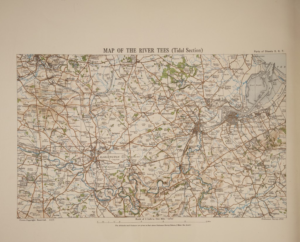
![A MAP OF THE RIVER TEES (Tidal Section) | vet eae ™ 'y § Cobby \¢ Castle * eee ere SSyddei : Z es \ Pas P oy Kirk Gare \ ky y , \M i 0 on q GW ; _ f Ee 4 .- 6 ee . u iM, \ i ) ' Fm. po ve Pro. : i a . by H +f si as te “ v2 ‘ Ho, Le 1 Yo 7] 2 4 6 & Miles } The Altitudes and Contours are given in Feet above Ordnance Survey Datum,( Mean Sea Level: )](https://iiif.wellcomecollection.org/image/b32179595_0001_0004.jp2/full/800%2C/0/default.jpg)