Volume 1
Opus majus / edited, with introduction and analytical table by John Henry Bridges.
- Roger Bacon
- Date:
- 1897-1900]
Licence: In copyright
Credit: Opus majus / edited, with introduction and analytical table by John Henry Bridges. Source: Wellcome Collection.
Provider: This material has been provided by Royal College of Physicians, London. The original may be consulted at Royal College of Physicians, London.
495/608 (page 295)
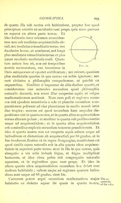
![euntis per polos et extremitates medietatis aequinoctialis1 sub hac figura, ideo in executione sententiae mathematicorum oportet relinqui quod incertum est, et fieri sermonem de eo quod philosophis magnis innotescit. Ptolemaeus2 inter omnes ab incarnatione Domini maxime certificavit in hac parte, et in secundo Almagesti quartam istam, in qua sumus, distinguit. Et ejus et Alfragani et aliorum divisio magis nota est per septem climata famosa. Clima vero apud eos est spatium terrae in quo dies prolixior excedit per dimidiam horam diem prolixiorem alterius partis terrae, vel exceditur ab eodem. Certum tamen est quod magis naturalis et verior distinctio esset penes quartam horae, secundum quod Ptolemaeus primo dividit: sed quia istae partes sunt parvae, ideo considerant philosophi majores et conjunxerunt duas illarum in uno climate. Et quoniam haec climata et civitates famosae in eis non possunt evidenter percipi sermone, oportet 1 The words, ‘et medietatem coluri . . . medietatis aequinoctialis’ are printed twice over in Jebb's edition. 2 In the first printed edition of Ptolemy’s Cosmographia, dedicated to Pope Sixtus IV, in 1478, there are twenty-seven maps : one of the World, ten of Europe, four of Africa, twelve of Asia. These correspond exactly to the description given in the eighth book of the Cosmographia. In all of them parallels of latitude and meridians are given, as in modern Atlases. In his map of the World, embracing as it did, on his system, 180 degrees of longitude and 80 degrees of latitude, a very elaborate and scientific attempt is made to project those curved lines accurately on a plane surface. It appears probable that these maps are the work of Agathodaemon of Alexandria a contemporary of Ptolemy. [Bunbury, vol. ii. p. 578.] The parallels of latitude are twenty-five in number: four of South latitude, twenty-one of North. They are arranged according to the length of the day at the Summer solstice, by intervals of one quarter of an hour. Beginning with 160 25' S. where the longest day is thirteen hours, proceeding north to the Equator where it is twelve; thence northwards to lat. 450. From this point the parallels are drawn at half-hourly intervals to lat. 58°, where the longest day is eighteen hours. The next parallel is drawn at 6i°, the day being nineteen hours ; the last at 63°, where it is twenty hours. This, says Ptolemy, is the latitude of Thule. In Ptolemy's Atlas longitude is calculated in degrees and half degrees, taking as the starting-point the meridian of the Fortunate islands (Ferro in the Canary islands), which he wrongly estimated as being only 20 30' west of the Sacred Promontory (Cape St. Vincent). Further, owing to his acceptance of Posidonius’ estimate of the Earth’s magnitude, 180,000 stadia, his degrees of longitude as measured on the Equator, were only 500 stadia (i. e. fifty geographical miles instead of sixty). The seven zones of Ptolemy and Al- fraganus.](https://iiif.wellcomecollection.org/image/b24975655_0001_0495.jp2/full/800%2C/0/default.jpg)