Skip to main content
Wellcome Collection homepage
Visit us
What’s on
Stories
Collections
Get involved
About us
Sign in to your library account
Search for anything
Library account
Search for anything
Search
Home
|
Collections
Thomas Kitchin
English engraver and cartographer (1718–1784)
Wikidata
Source:
Wikidata
On this page
On this page
Images from the collections
Works from the collections
Images from the collections
Images by Thomas Kitchin
2 images from works
Works from the collections
4 works
E-books
Online
The Small English atlas being a new and accurate sett of maps of all the counties in England and Wales
|
Date: 1749
Pictures
Online
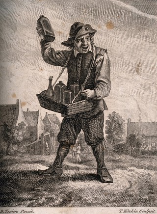
A country pedlar selling medicines from a basket. Etching by T. Kitchin after D. Teniers the younger.
|
David Teniers the Younger
|
Reference: 16377i
Pictures
Online
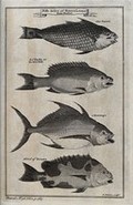
A variety of fish from Sierra Leone, including a parrot-fish. Etching by T. Kitchen.
|
Reference: 41983i
E-books
Online
The large English atlas or, a new set of maps of all the counties in England and Wales, drawn from the several surveys which have been hitherto published. With three general Maps of England, Scotland, and Ireland, From the latest and best Authorities. 1 England 2 Scotland 3 Ireland 4 Bedfordshire 5 Berkshire 6 Buckinghamshire 7 Cambridgeshire 8 Cheshire 9 Cornwall 10 Derbyshire 11 Devonshire 12 Dorsetshire 13 Durham 14 Essex 15 Gloucestershire and Monmouthshire 16 Hampshire 17 Hertfordshire 18 Herefordshire 19 Huntingdonshire 20 Kent 21 Lancashire 22 Leicestershire and Rutlandshire 23 Lincolnshire 24 Middlesex 25 Norfolk 26 Northamptonshire 27 Northumberland 28 Nottinghamshire 29 Oxfordshire 30 Shropshire 31 Somersetshire 32 Staffordshire 33 Suffolk 34 Surrey 35 Sussex 36 Warwickshire 37 Westmoreland and Cumberland 38 Wiltshire 39 Worcestershire 40 Yorkshire 41 East Riding of ditto 42 North Riding of ditto 43 West Riding of ditto 44 Cardiganshire and Pembrokeshire 45 Carmarthenshire and Glamorganshire 46 Radnorshire and Brecknockshire 47 North Wales, Containing in one Map the Counties of Carnarvon Denbigh Flint Merioneth Montgomery and The Island of Anglesey laid down on a large scale, And containing all the Cities, Towns, Villages, and Churches, whether Rectories or Vicarages, Chapels, many Noblemen's and Gentlemen's Seats, &c. &c. Each Map is Illustrated With a General Description of the County, its Cities, Borough and Market Towns, the Number of Members returned to Parliament, of Parishes, Houses, Acres of Land, &c. And Historical Extracts relative to the Trade, Manufactures, and Government of the Cities and Principal Towns, and the present State of their Inhabitants, &c. By Emanuel Bowen, Geographer to His Majesty, Thomas Kitchen, and others.
|
Bowen, Emanuel d. 1767.
|
Date: 1777
Close modal window