Skip to main content
Wellcome Collection homepage
Visit us
What’s on
Stories
Collections
Get involved
About us
Sign in to your library account
Search for anything
Library account
Search for anything
Search
Home
|
Collections
Topographic maps
Medium to large scale map that shows a precise map of the terrain
Wikidata
Source:
Wikidata
On this page
On this page
Images from the collections
Works from the collections
Images from the collections
Images of Topographic maps
3 images from works
Works from the collections
4 works
Pictures
Online
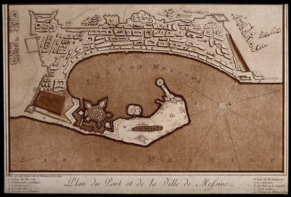
Messina, Sicily, Italy: map of the port; with numbered key. Tinted aquatint after Villamaga, 1699.
Villamaga.
|
Reference: 18376i
Pictures
Online
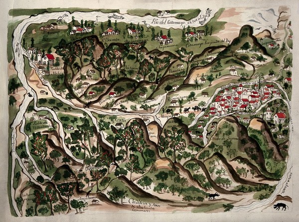
A map of the area of Villcabamba, Ecuador, illustrated with buildings, rivers, people, animals and flowering plants and trees. Watercolour.
|
Date: 1934
|
Reference: 16313i
Pictures
The island of St Helena: map. Photozincograph, 1904.
|
Date: [1904]
|
Reference: 2848334i
Pictures
Online
Soraluze-Placencia de las Armas, Spain: the town and its surrounding places, its armaments factory, inscribed tabernacles describing them, and dedications to King Ferdinand VI and the Conde de Aranda. Engraving by J.F. Palomino after J. Zameza after F.J. de Lamot, 1756.
Lamot, Florencio Joseph de, 1701-1779.
|
Date: [1756]
|
Reference: 576672i
Close modal window