M0012995: Illustration of a map of the Americas, Africa and Europe

Date:
April 1953
Reference:
WT/D/1/20/1/116/18
Part of:
Wellcome Trust Corporate Archive
  • Archives and manuscripts
  • Online

Available online

view M0012995: Illustration of a map of the Americas, Africa and Europe

Contains: 1 image

Public Domain Mark

You can use this work for any purpose without restriction under copyright law. Read more about this licence.

Credit

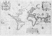
M0012995: Illustration of a map of the Americas, Africa and Europe. Public Domain Mark. Source: Wellcome Collection.

About this work

Description

Photograph of an engraving showing a map of the Americas, Africa and Europe, reproduced from a facsimilie published by the Hakleyt Society in 1880.

Publication/Creation

April 1953

Physical description

1 photograph glass plate negative; 12 x 16.5 cm

Notes

Catalogue data comes from a combination of entries in the original glass plate registers, metadata created when the glass plates were digitised in the early 2000s and enhancements made by the cataloguer in 2022.

Terms of use

Please consult the digitised version as this item is fragile. Email library@wellcomecollection.org to request access to the physical item.

Where to find it

  • Location Access
    Closed stores
    Can't be requested

    Note

Permanent link